China Geography Maps(Esclude Hongkong, Taiwan)
Location:Eastern Asia, bordering the East China Sea, Korea Bay, Yellow Sea, and South China Sea, between North Korea and Vietnam
Geographic coordinates: 35 00 N, 105 00 E
Map references: Asia
Area: total: 9,596,960 sq km, land: 9,326,410 sq km, water: 270,550 sq km
Area-comparative: slightly smaller than the US
Land boundaries:
total: 22,143.34 km
border countries: Afghanistan 76 km, Bhutan 470 km, Burma 2,185 km, Hong Kong 30 km, India 3,380 km, Kazakhstan 1,533 km, North Korea 1,416 km, Kyrgyzstan 858 km, Laos 423 km, Macau 0.34 km, Mongolia 4,673 km, Nepal 1,236 km, Pakistan 523 km, Russia (northeast) 3,605 km, Russia (northwest) 40 km, Tajikistan 414 km, Vietnam 1,281 km
Coastline: 14,500 km
Maritime claims: contiguous zone: 24 nm, continental shelf: 200 nm or to the edge of the continental margin
territorial sea: 12 nm
Climate: extremely diverse; tropical in south to subarctic in north
Terrain: mostly mountains, high plateaus, deserts in west; plains, deltas, and hills in east
Elevation extremes: lowest point: Turpan Pendi -154 m, highest point: Mount Everest 8,848 m
Natural resources: coal, iron ore, petroleum, natural gas, mercury, tin, tungsten, antimony, manganese, molybdenum, vanadium, magnetite, aluminum, lead, zinc, uranium, hydropower potential (world's largest)
Land use:
arable land: 10% permanent crops: 0% permanent pastures: 43% forests and woodland: 14% other: 33% (1993 est.) Irrigated land: 498,720 sq km (1993 est.)
Natural hazards: frequent typhoons (about five per year along southern and eastern coasts); damaging floods; tsunamis; earthquakes; droughts
Environment-current issues: air pollution (greenhouse gases, sulfur dioxide particulates) from reliance on coal, produces acid rain; water shortages, particularly in the north; water pollution from untreated wastes; deforestation; estimated loss of one-fifth of agricultural land since 1949 to soil erosion and economic development; desertification; trade in endangered species
Environment-international agreements:
party to: Antarctic-Environmental Protocol, Antarctic Treaty, Biodiversity, Climate Change, Desertification, Endangered Species, Hazardous Wastes, Law of the Sea, Marine Dumping, Ozone Layer Protection, Ship Pollution, Tropical Timber 83, Tropical Timber 94, Wetlands, Whaling
signed, but not ratified: Climate Change-Kyoto Protocol, Nuclear Test Ban
Geography-note: world's fourth-largest country (after Russia, Canada, and US)
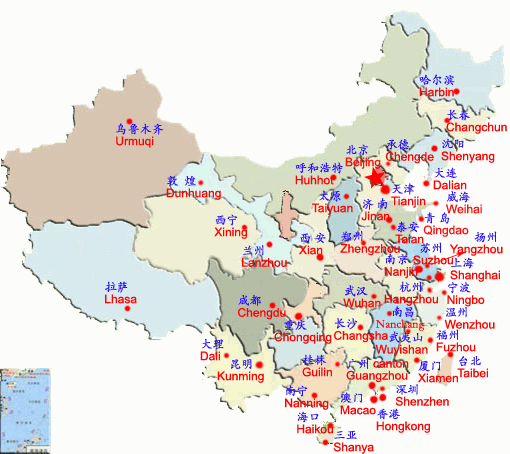
Main Cities in China Travel and China Hotels


 Beijing Canton
Shanghai Hong
Kong Qingdao Hangzhou Beijing Canton
Shanghai Hong
Kong Qingdao Hangzhou |
Other Major Cities:
Changchun,
Chengdu,
Chongqing,
Dalian,
Dongguan,
Dunhuang,
Foshan,
Guangzhou,
Guilin,
Haikou,
Harbin,
Hainan,
Hangzhou,
Kunming,
Lhasa,
Macau,
Nanjing,
Qingdao,
Sanya,
Shenyang,
Suzhou
Shanghai,
Shenzhen,
Tianjin,
Weihai,
Wenzhou,
Xiamen,
Xi'an,
Yiwu
|
Major China Hotels:
Beijing Hotels,
Chengdu Hotels,
Chongqing Hotels,
Dalian Hotels,
Foshan Hotels,
GuangZhou Hotels,
Guilin Hotels,
Hangzhou Hotels,
Harbin Hotels,
HongKong Hotels,
Kunming Hotels,
Macau Hotels,
Nanjing Hotels,
Qingdao Hotels,
Sanya Hotels,
Shanghai Hotels,
Shenyang Hotels,
Suzhou Hotels,
Tianjin Hotels,
Urumqi Hotels,
Wenzhou Hotels,
Xiamen Hotels,
Xian Hotels |
China GEOGRAPHIC DISTRIBUTION OF INDUSTRY
Before 1949 industry was concentrated in the large east-coast cities and in the northeast. Shanghai was the largest industrial center, followed by Anshan, Fushun, and Shenyang, all in Liaoning Province. Qingdao, in Shandong, and Tianjin also were important industrial centers. Only a few cities in the interior had any modern industry; they included Wuhan, Chongqing, and Taiyuan . Major Industrial Areas and Facilities, 1983).
During the First Five-Year Plan (1953-57), the government specifically emphasized development of the northeast and areas other than Shanghai, China's most important industrial base. Industrial sites were constructed in the north around the new steel mills at Baotou, Nei Monggol Autonomous Region, and in central China in Wuhan, Hubei Province. Industrial centers also arose in the southwest, mostly in Sichuan Province.
In the 1950s, industrial centers in east and northeast China accounted for approximately two-thirds of total industrial output. However, by 1983 industrial centers in the north, south, and southwest had increased their share of output to more than 40 percent , Percentage Distribution of Gross Industrial Output Value by Region, 1983). This increase was the result of a policy begun in the 1950s to gradually expand existing industrial bases to new areas, to build new bases in the north and south, and to establish a new base in the southwest.
From 1952 to 1983, south, southwest, and northwest China registered higher industrial growth than the east, northeast, and north regions. Total industrial output grew the fastest in the south--from 13.7 percent of total output in 1952 to 18.5 percent in 1983, Gross Value of Industrial Output, By Province, 1952, 1957, 1983. Appendix A). The government had stressed developing the interior regions since the 1950s, but by 1986 it had abandoned that strategy in order to develop areas with more established infrastructures. According to this plan, the south would continue growing, but the east and northeast would be the main benefactors. |